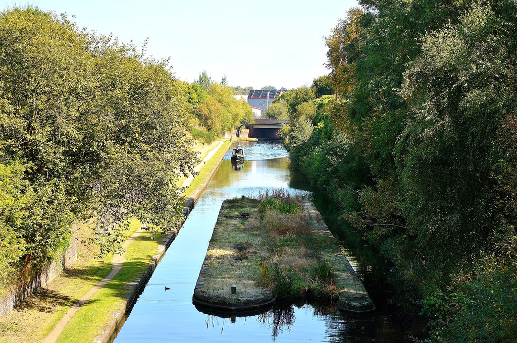
Looking down towards Smethwick Stop on the old Birmingham Main Line canal from Engine Arm Aqueduct which carries the Engine Arm Canal Viaduct away from the new Birmingham Main Line canal. In Smethwick, Sandwell, West Midlands.
On 24 January 1767 a number of prominent Birmingham businessmen, including Matthew Boulton and others from the Lunar Society, held a public meeting in the White Swan, High Street, Birmingham to consider the possibility of building a canal from Birmingham to the Staffordshire and Worcestershire Canal near Wolverhampton, taking in the coalfields of the Black Country. They commissioned the canal engineer James Brindley to propose a route. Brindley came back with a largely level route via Smethwick, Oldbury, Tipton, Bilston and Wolverhampton to Aldersley.
On 24 February 1768 an Act of Parliament was passed to allow the building of the canal, with branches at Ocker Hill and Wednesbury where there were coal mines. The first phase of building was to Wednesbury whereupon the price of coal sold to domestic households in Birmingham halved overnight. Vested interests of the sponsors caused the creation of two terminal wharves in Birmingham. The 1772 Newhall Branch and wharf (now built upon) originally extended north of, and parallel to Great Charles Street. The 1773 Paradise Street Branch split off at Old Turn Junction and headed through Broad Street Tunnel, turned left at what is now Gas Street Basin and under Bridge Street to wharves on a tuning fork-shaped pair of long basins: Paradise Wharf, also called Old Wharf. The Birmingham Canal Company head office was finally built there, opposite the western end of Paradise Street.
By 6 November 1769, 10 miles (16 km) had been completed to Hill Top collieries in West Bromwich, with a one mile summit pound at Smethwick. Brindley had tried to dig a cutting through the hill at Smethwick but had encountered ground too soft to cope with. The canal rose through six narrow (7 ft) locks to the summit level and descended through another six at Spon Lane. pool at Smethwick (holding 500 locks), and then from Titford Pool to supply the summit level.
In 1770 work started towards Wolverhampton. On 21 September 1772 the canal was joined with the Staffordshire and Worcestershire Canal at Aldersley Junction via another 20 locks (increased to 21 in 1784 to save water). Brindley died a few days later. The canal measured 22 miles and 5 furlongs (22⅝ miles), mostly following the contour of the land but with deviations to factories and mines in the Black Country and Birmingham.
Over the next thirty years, as more canals and branches were built or connected it became necessary to review the long, winding, narrow Old Main Line. With a single towpath boats passing in opposite directions had to negotiate their horses and ropes. In 1824 Thomas Telford was commissioned to examine alternatives. He famously travelled the route of the Old Line and reported the existing canal as:
"… little more than a crooked ditch, with scarcely the appearance of a towing path, the horses frequently sliding and staggering in the water, the hauling lines sweeping the gravel into the canal, and the entanglement at the meeting of boats being incessant; whilst at the locks at each end of the short summit at Smethwick, crowds of boatmen were always quarrelling, or offering premiums for the preference of passage; the mine owners injured by the delay, were loud in their just complaints."
Telford proposed major changes to the section between Birmingham and Smethwick, widening and straightening the canal, providing towpaths on each side, and cutting through Smethwick Summit to bypass the locks, allowing lock-free passage from Birmingham to Tipton.
By 1827 the New Main Line passed straight through, and linked to, the loops of the Old Main Line, creating Oozells Loop, Icknield Port Loop, Soho Loop, Cape Loop and Soho Foundry Loop, allowing continued access to the existing factories and wharves.
A year earlier he had built an improved Rotton Park Reservoir (Edgbaston Reservoir) on the site of an existing fish pool, bringing its capacity to 300 million imperial gallons (1,400,000 m3). A canal feeder took water to, and along, a raised embankment on the south side of the New Main Line to his new Engine Arm branch canal and across an elegant cast iron aqueduct to top up the higher Wolverhampton Level at Smethwick Summit. The reservoir also fed water to the Birmingham Level at the adjacent Icknield Port Loop.
The Smethwick Summit was bypassed by 71 ft cutting through Lunar Society member, Samuel Galton's land, creating the Galton Valley, 70 feet deep and 150 feet wide, running parallel to the Old Main Line. Telford's changes here were completed in 1829.
By 1838 the New Main Line was complete: 22⅝ miles of slow canal reduced to 15⅝; between Birmingham and Tipton, a lock-free dual carriageway. It was also called the Island Line as it was cut straight through the hill at Smethwick known as the Island.